

Your cart
There are no more items in your cart

 100% secure payments

From
€28.50
Out-of-Stock
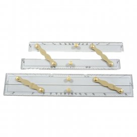
The sturdy, acrylic, brass arms Parallel Ruler includes a protractor scale, is easy to use, and is a necessary tool for every seagoing navigator.


