

Your cart
There are no more items in your cart
")
 100% secure payments


€14.00
Available
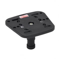
This Berkley Fish Finder Holder has a top plate, that can accommodate small fish finders, from most popular brands.


