

Your cart
There are no more items in your cart


 Yachting...")
 Yachting...")
 100% secure payments


€27.00
Available
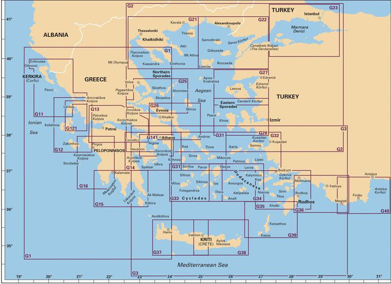
The eagleray pilot chart is a completechart, published under permission from the Greek Hydrographic Office, that offers in addition pilot information.


